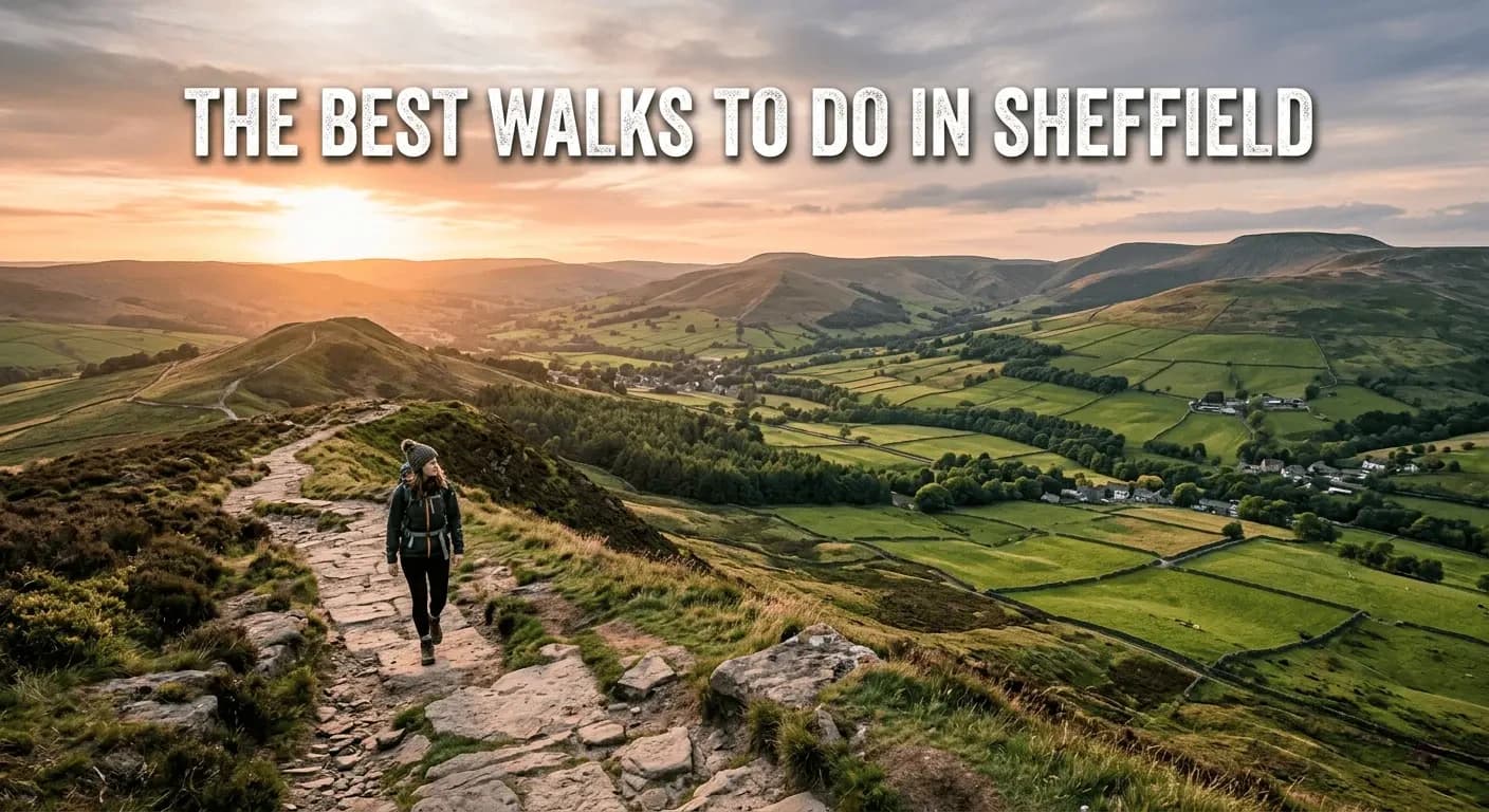
The Best Walks to Do in Sheffield
People who've never been to Sheffield are often surprised by it. They expect a city - grey, industrial, hemmed in. What they find instead is a place with more trees per person than almost anywhere else in England, a national park on its doorstep, and river valleys threading through the outskirts like the city grew around them rather than over them.
Sheffield has over 170 parks. Two-thirds of its land is green or blue space. The Peak District begins, depending on which way you're heading, somewhere between 20 minutes and a brisk walk from the city centre. It's a genuinely extraordinary place to go for a walk.
These five routes mix the urban and the wild. Some you can get to on the tram. Others need a bus or a short drive. All of them are worth your time.
1. The Rivelin Valley Trail
Distance: 2.5 miles one way (5 miles return)
Difficulty: Easy
Start: Malin Bridge tram stop (Blue route) or Walkley Bank Tilt car park, S6 5FY
Time: 1.5 to 3 hours depending on pace
This is Sheffield's most quietly extraordinary walk, and a lot of people who've lived here for years have never done it.
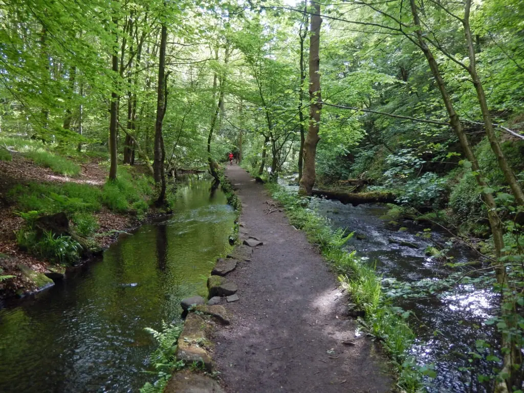
The Rivelin Valley Trail follows the River Rivelin from Malin Bridge northwest toward the Peak District, through a wooded valley that looks like it belongs in a nature documentary rather than the edge of a major city. The river rises on the Hallam Moors and drops down through ancient woodland, past waterfalls, stepping stones and ponds. It's the kind of place that genuinely changes your mood within about five minutes of arriving.
The history is what sets it apart from a standard woodland walk. Along the 2.5-mile trail, you'll pass the remains of 20 watermills and 21 mill dams, dating from the 16th to the 19th century. Cutlery grinding, metal forging, paper mills, corn mills - this quiet valley once powered an enormous chunk of Sheffield's industrial output. Today most of it is overgrown and returned to nature, but the mill pits, dam walls and weirs are still there if you know what you're looking at. Information posts with QR codes explain each site as you go.
At the lower end of the trail, there's a cafe at Rivelin Park with outdoor seating, toilets, a children's play area, and a water park that's open in summer. It's the perfect halfway point if you're doing the return route.
The trail is mostly flat and accessible, though it can get muddy after rain and isn't suitable for pushchairs or mobility scooters. Dogs are welcome and the off-lead stretches are long.
Getting there without a car: Blue tram to Malin Bridge, then a 20-minute walk to the trailhead, or bus 61/62 or 81/82.
2. Ecclesall Woods
Distance: 2 to 4 miles depending on route
Difficulty: Easy to moderate
Start: Woodland Discovery Centre, Abbey Lane, S11 9NW
Time: 45 minutes to 2 hours
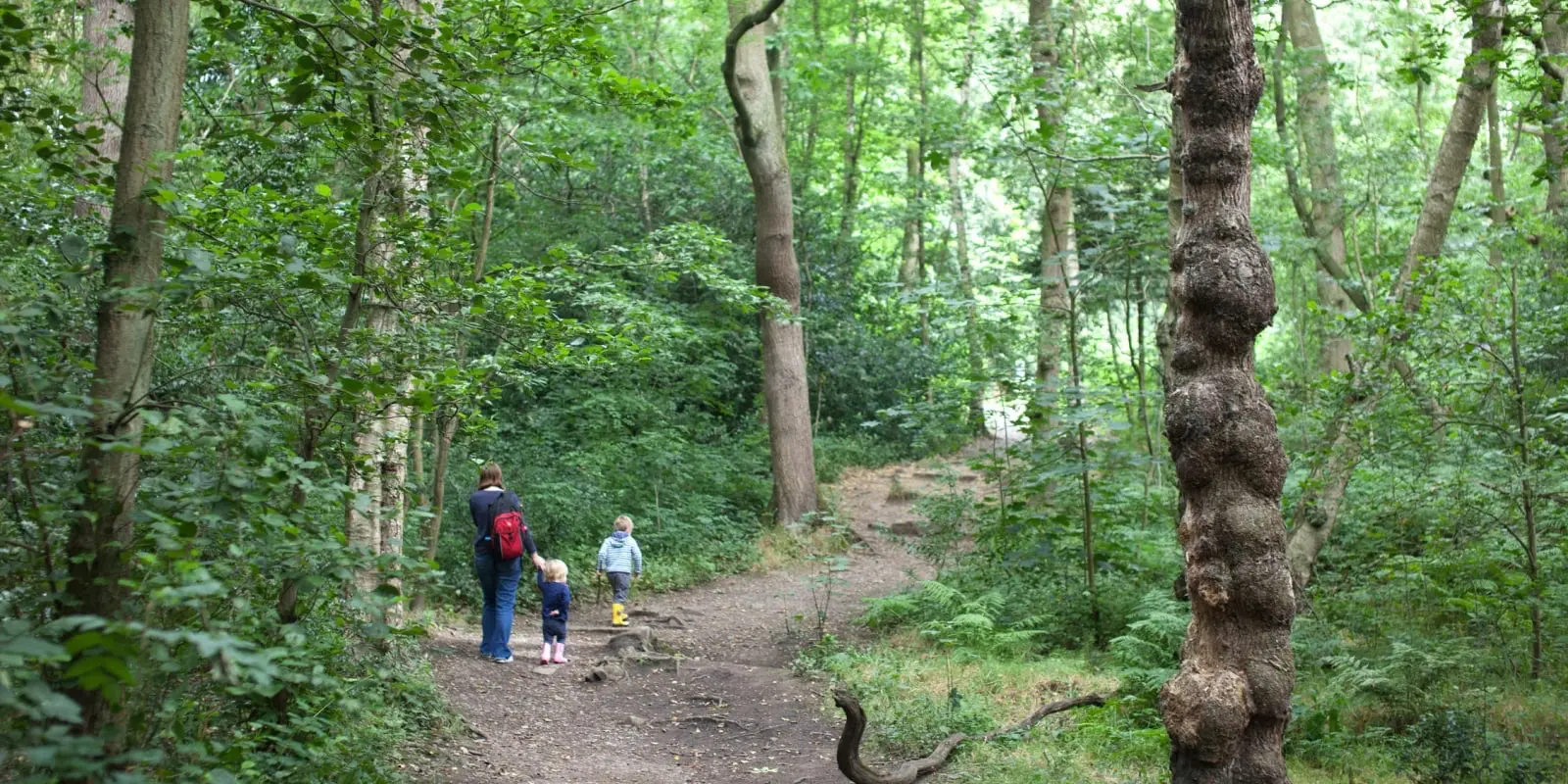
Ecclesall Woods is the largest area of ancient woodland in South Yorkshire. Over 300 acres of it, with more than 15 kilometres of paths cutting through deciduous forest that's been here, in some form or other, since at least the 1600s. The city council calls it the "jewel in the crown" of Sheffield's woodland estate, which is the sort of thing councils say, but in this case it's more or less accurate.
The paths are wide and well-maintained, which means the woods are popular - dog walkers, runners, mountain bikers, families with buggies for the flatter sections. It doesn't feel crowded, though. The canopy is thick enough and the route network varied enough that you can usually find a quieter stretch without much effort.
Spring is the season to aim for if you can, when the bluebells come out across the forest floor. It's genuinely one of the better natural spectacles in the city. Autumn is close behind, when the oaks and birches go full amber and gold. The woods sit on soils that link back to ancient habitats, and the biodiversity shows - woodpeckers, treecreepers, squirrels, and the occasional deer if you're quiet and lucky.
The Woodland Discovery Centre at the entrance is a good starting point, with parking on site and a coffee kiosk that walkers consistently rate highly. The walk finishes back there, at what's known locally as the Woodland Coffee Stop. The J G Graves Charitable Trust helped develop the centre and the woods are open at all times with no admission charge.
For those who want more distance, the long-distance Sheffield Round Walk passes straight through Ecclesall Woods, connecting it west toward Whirlow Brook Park and Limb Valley.
Getting there without a car: Bus 218 has a request stop on Abbey Lane right by the entrance.
3. The Five Weirs Walk
Distance: 5 miles one way, or 8 miles as the Blue Loop circular
Difficulty: Easy to moderate (mostly flat)
Start: Lady's Bridge, Castlegate, S3 8GA
Finish: Meadowhall Shopping Centre (or loop back via canal towpath)
Time: 2 to 2.5 hours one way
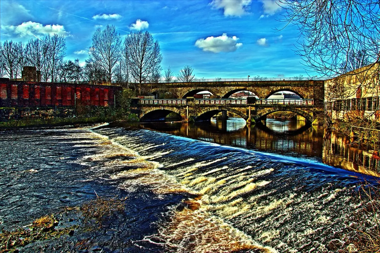
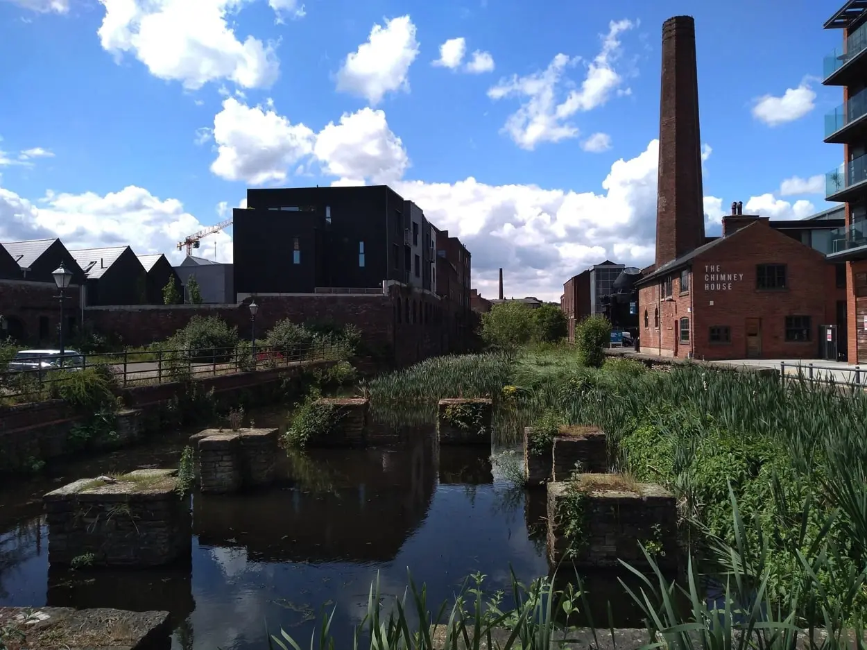
This is Sheffield's definitive urban walk. It starts at Lady's Bridge in the city centre - the oldest bridge in Sheffield, with over 400 years of history - and follows the River Don northeast through the former industrial heartlands of Attercliffe, Brightside and Carbrook, all the way to Meadowhall Shopping Centre.
The route takes its name from the five historic weirs it passes along the way. These were the water-powered engines of Sheffield's industrial age, driving the mills and forges that made the city famous. The factories have mostly gone now, but the weirs remain, and so do the extraordinary remnants of what Sheffield once was - rusted infrastructure, Victorian brickwork, riverside architecture that no other city in England quite has.
It's not a conventionally pretty walk. Parts of it are industrial and unpolished. But that's the point. The Five Weirs Walk takes you through a version of Sheffield that most visitors never see, and does it along a flat, well-surfaced path that's accessible to most people.
Note: as of early 2026, a short section between Attercliffe Road and East Coast Road is temporarily closed due to flood damage and diverts onto roads instead. Check the Trans Pennine Trail website for the latest before you go.
At Meadowhall you have options: tram back to the city centre in about 10 minutes, walk the same route back, or take the Sheffield-Tinsley Canal towpath for the return journey to complete the 8-mile Blue Loop circular. The canal towpath adds a different feel - quieter, leafier, and parallel to the river for most of its length.
Getting there: Walk from Sheffield city centre. Return by Yellow tram from Meadowhall.
4. Kelham Island Urban Walk
Distance: 1.5 to 2.5 miles depending on route
Difficulty: Easy
Start: Sheffield city centre (Lady's Bridge or Kelham Island Museum, S3 8RY)
Time: 1 to 2 hours
Kelham Island is technically a man-made island, formed 900 years ago when a mill race was cut from the River Don. For most of its history it was the engine room of Sheffield - cutlery grinding, steel forging, cotton mills, the lot. Then the heavy industry left, and for a while it sat empty. Now it's been named one of the best urban neighbourhoods in Britain, and the New York Times included its pubs on a list of the world's best places to visit.
The walk itself is short and manageable. Starting from Lady's Bridge in the city centre, you follow the river into Kelham along cobbled streets past buildings that have been doing things with metal since before anyone can clearly remember. Green Lane Works. Cornish Place. Globe Works, reputedly the oldest factory in the world, now home to artisans and a cafe bar. The Kelham Island Museum sits at the heart of it, and entry is free - if you've got any interest in how Sheffield became Sheffield, an hour in there is worth it.
Beyond the history, Kelham is now one of Sheffield's most interesting areas for independent food and drink, with bars, breweries and restaurants filling buildings that a decade ago were empty shells. The Fat Cat, Kelham Island Brewery's tap, has been here since the early nineties. The Kelham Island Tavern is one of CAMRA's most awarded pubs in the country.
Guided tours run regularly via Kelham Island Walks, led by local historian Anders Hanson, for around £10. If you want the stories behind what you're looking at - the anti-slavery campaigners, the murderers, the groundbreaking poets - booking a tour is well worth it. Self-guided is fine too, with information panels throughout the area.
Getting there: 10 to 15 minutes on foot from Sheffield city centre. Free Sheffield Connect bus SC2 stops on Millsands nearby.
5. Endcliffe Park to Forge Dam
Distance: 3 miles one way (6 miles return)
Difficulty: Easy to moderate
Start: Endcliffe Park, S11 7AB
Time: 1.5 to 2.5 hours
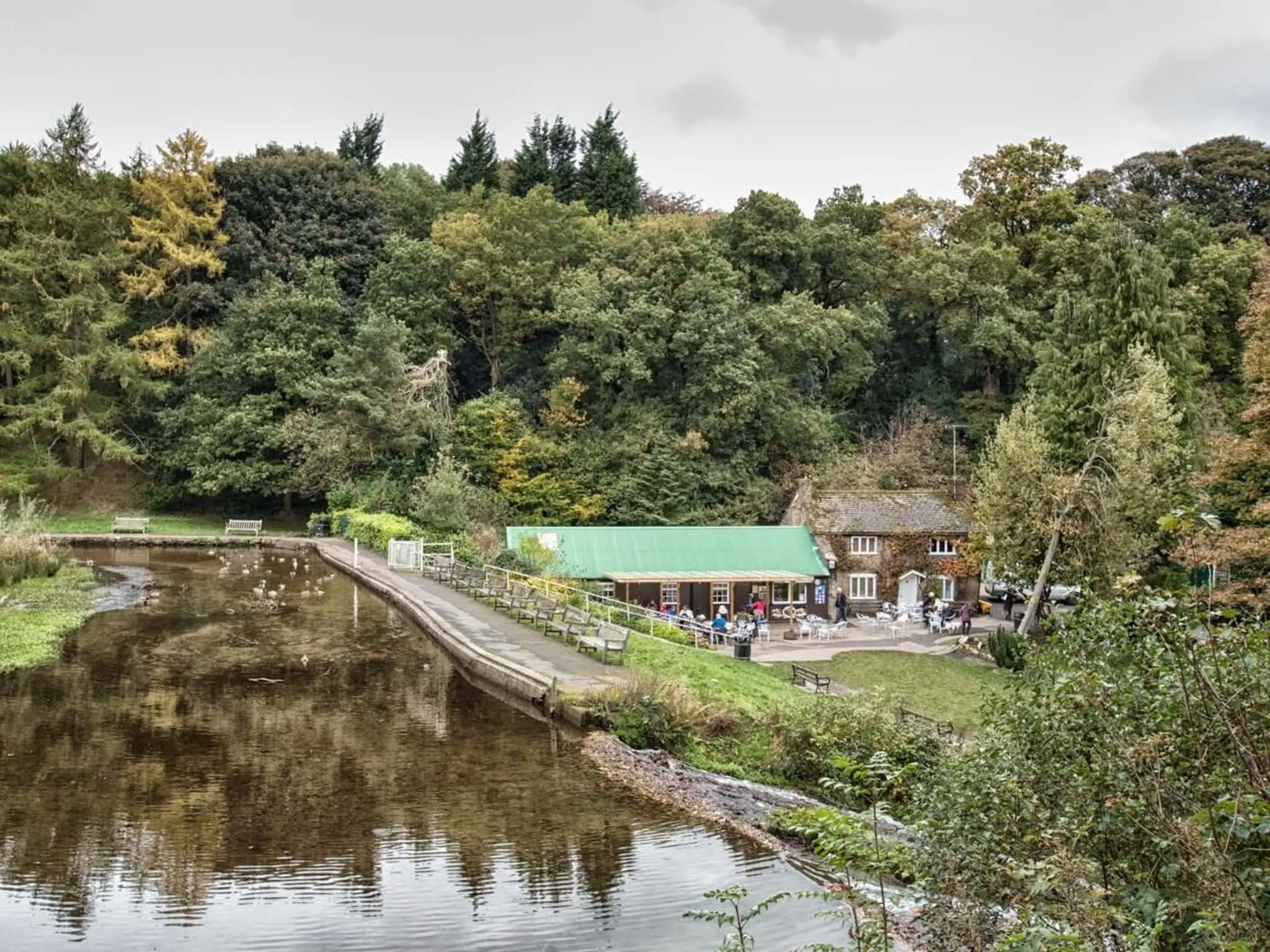
This is the walk that Sheffield people do with visiting relatives when they want to show the city at its greenest. Starting at Endcliffe Park, one of Sheffield's most popular green spaces just a couple of miles southwest of the city centre, the route follows Porter Brook upstream through a chain of Victorian parks - Bingham Park, Whiteley Woods - climbing gradually into the woods before arriving at Forge Dam.
Forge Dam Park is a proper destination in its own right. There's a dam with views across the water, a trickling stream that's a reliable wildlife spot (herons, particularly), a children's playground, good picnic spots and a cafe that earns consistently strong reviews. On a sunny day, people come here specifically rather than as part of a walk.
The trail back is the same route in reverse, though from Endcliffe Park there's enough of a network that you can vary things on the return leg. The Sheffield Round Walk passes through this area, connecting west toward Ecclesall Woods if you've got more in you.
Endcliffe Park itself is worth arriving early for - there's a duck pond, riverside paths, a playground and a community feel that gets busy on weekends but rarely feels overcrowded. The Porter Brook runs through the park and the sound of the water is noticeable from most parts of it.
Getting there without a car: Buses 51, 52, and 120 all stop near Endcliffe Park from the city centre.
A Few Things Worth Knowing
Sheffield's public transport connects to more of these walks than you'd expect. The Blue tram to Malin Bridge gets you to the Rivelin Valley. The Yellow tram covers the Five Weirs Walk return from Meadowhall. Kelham Island is a short walk from the station. Ecclesall Woods and Endcliffe Park are accessible by bus.
The weather matters, especially for the Rivelin Valley and Ecclesall Woods. Both trails get muddy quickly after rain and the paths, though well-maintained, are uneven in places. Decent shoes over trainers is the right call for anything except Kelham Island.
Dogs are welcome on all five routes, though leads are requested in Ecclesall Woods given the mountain bike traffic.
Want More Sheffield?
Sheffield Weekly is a free newsletter covering the best of the city - new openings, local food, things worth knowing that don't always make the local news. No spam. No filler. Just Sheffield.
Sign up here and join the hundreds of Sheffield people already reading.
This guide was last updated March 2026. Always check trail conditions and transport times before setting out, particularly for the Five Weirs Walk where a section closure is currently in place.
Join 1000+ Sheffield locals in the know
Get the best of Sheffield delivered to your inbox every Sunday. Free forever.